IDTReeS
Integrating Data science with Trees and Remote Sensing
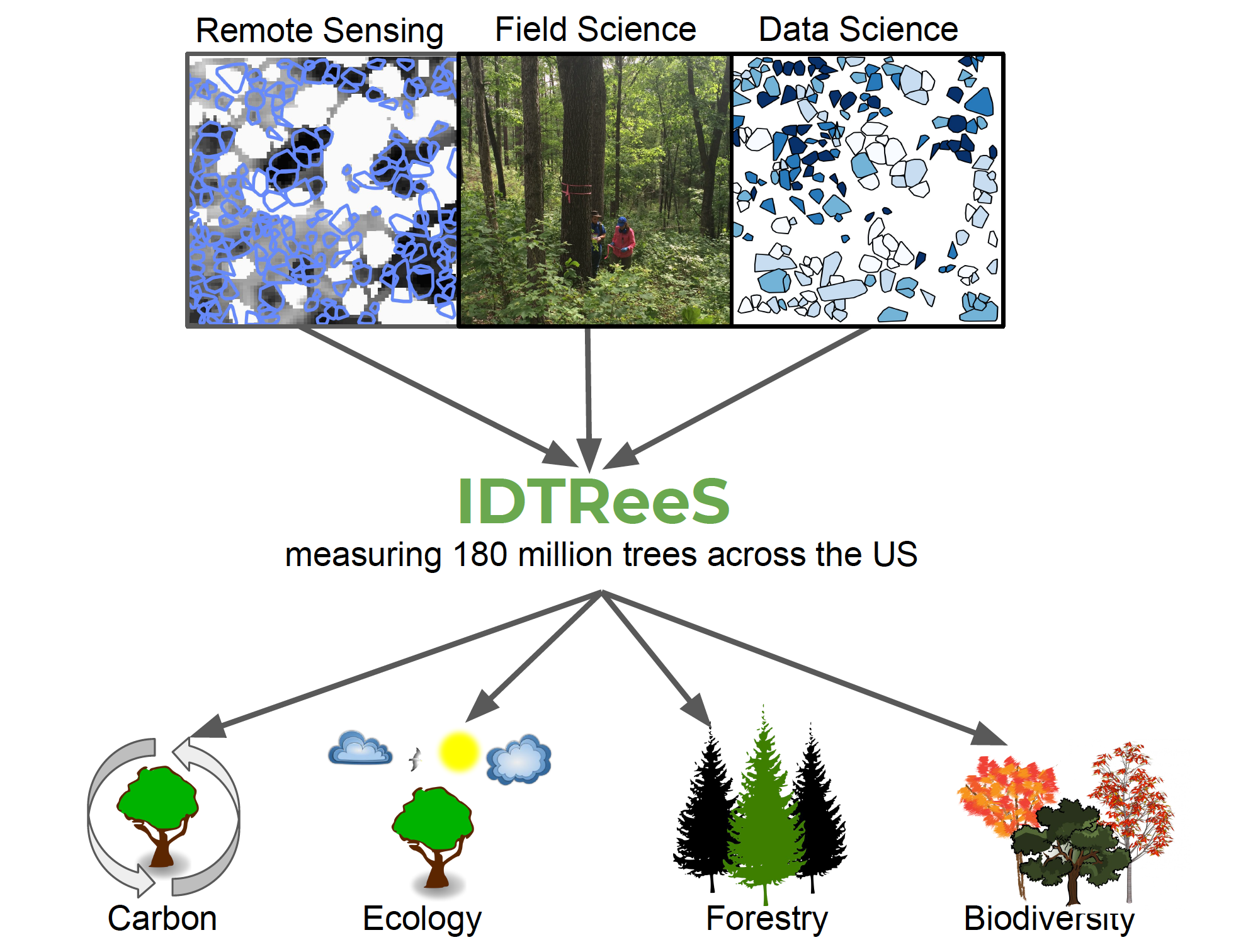
Understanding and managing forests is crucial to understanding and potentially mitigating the effects of climate change, invasive species, and shifting land use on natural systems and human society. However, collecting data on individual trees in the field is expensive and time consuming, which limits the scales at which this crucial data is collected. Combining large scale survey efforts with remotely sensed imagery from satellites, airplanes, and drones provide the potential to observe ecosystems at much larger scales than using field data alone.
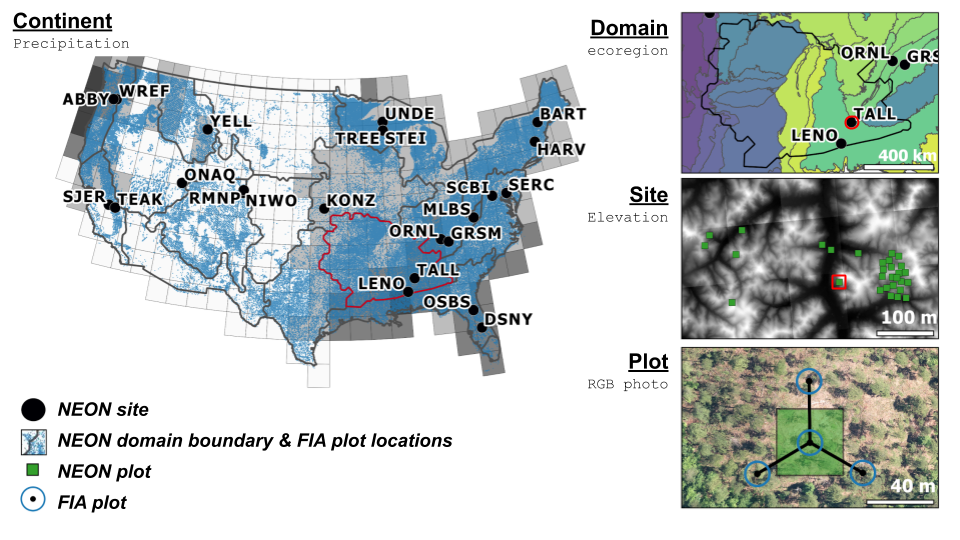
Our group works across scale from individual trees to the continent and incorporates a variety of field and remote sensing data including National Ecological Observatory Network (NEON; neonscience.org) and USFS Forest Inventory and Analysis (https://www.fia.fs.fed.us/).
What we do:
We are combining remote sensing imagery, large scale surveys, and data science methods, to help understand forests at scales from individual trees to entire continents. Our group will contribute to the following advancements (Read more about each of these aspects of our work on the Projects page):
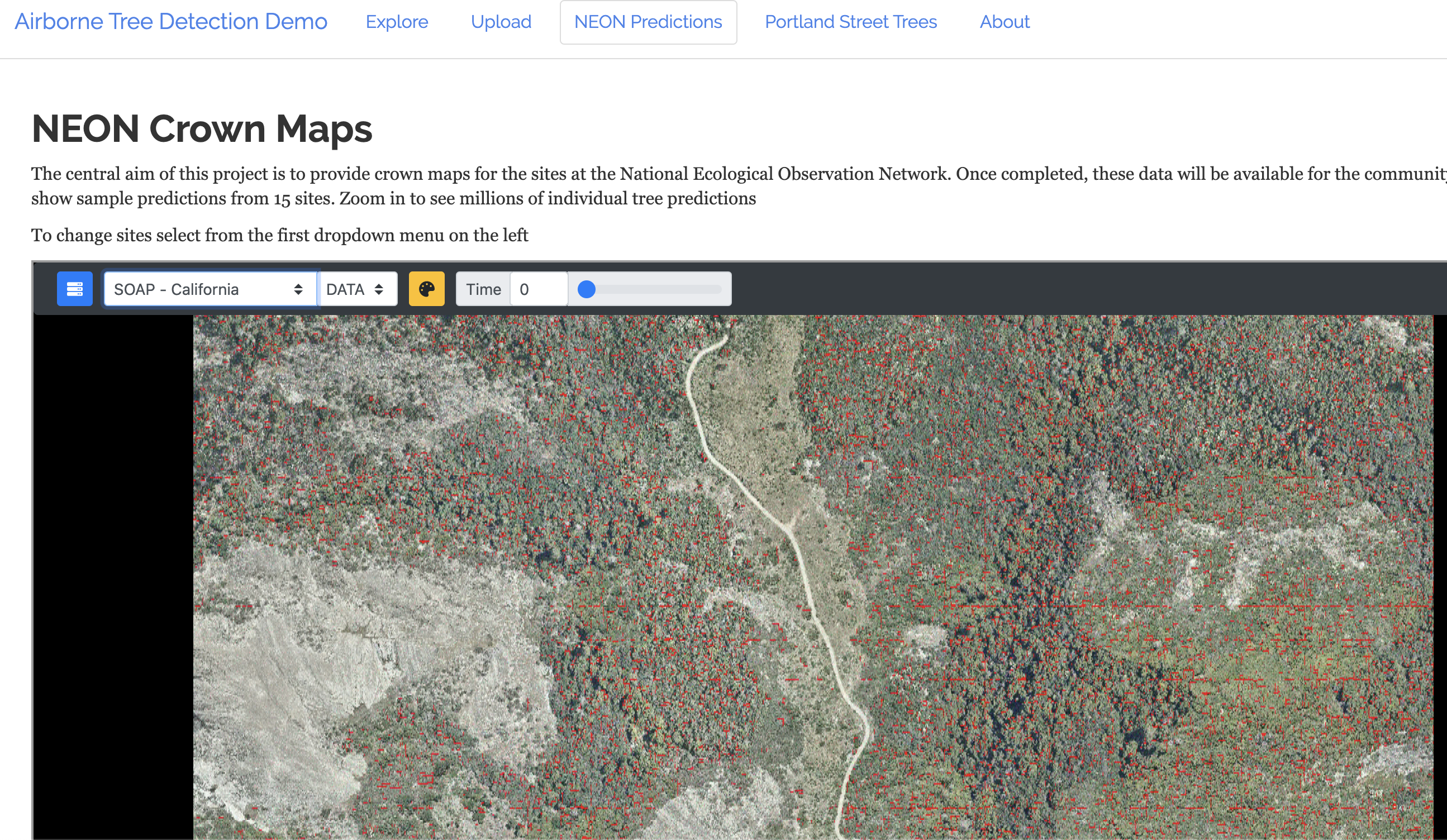
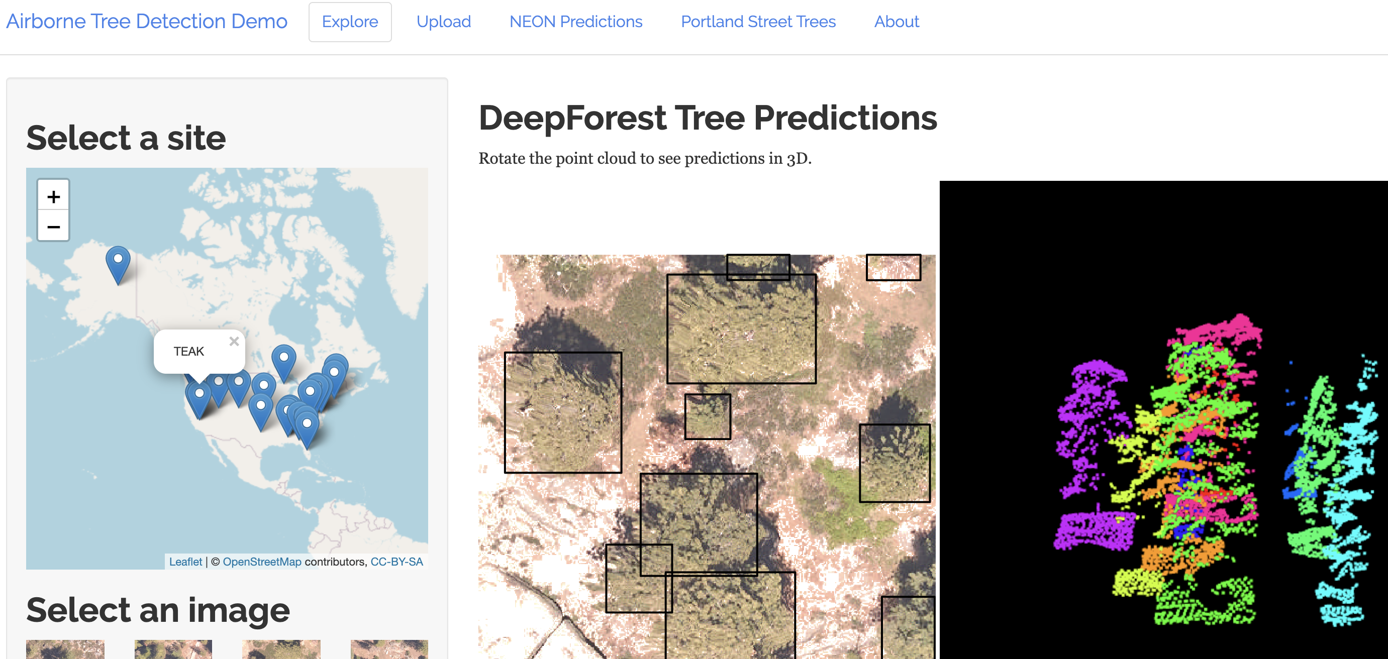
- View 115 million tree predictions from NEON (select NEON Predictions)
- Produce improved spatially explicit data on species and traits for ~50 million individual trees
- Disentangle the importance of processes driving species distribution, abundance, and biodiversity across scales, including cross-scale interactions.
- Develop cross-scale models of tree structural traits and allometry that incorporate environmental variation and biological interactions
We are also actively producing data sets, code, and protocols to allow for other researchers to easily build from what we have done. See the Products page for more information.
Who we are:
We are an interdisciplinary team of faculty and students based at the University of Florida, with post docs and researchers based across the US. Our combined expertise is in forest ecology, remote sensing, data science, machine learning, and modeling. Read more about our team members on the About Us page.
Data Science Challenge
A data science challenge using ecological data to scale up ecological patterns.
NIST DSE Plant Identification
NIST DSE Plant Identification with NEON Remote Sensing Data.
Find Us
Address Building 150, University of Florida, Gainesville, FL
Email contact@weecology.org